Tuesday, December 21, 2010

Just Plain Fun

The last couple of posts have been about long flights and I still need to tell the story of our July Fourth flight to Boston, Martha’s Vineyard and Lewiston, Maine but you need to keep in mind that between these epic journeys, we generally fly someplace every 2 weeks.  Some of these are informative (the Ford Museum in Dearborn or the Air Force Museum in Dayton).  Some of these are “always wanted to go” to, like the Rock and Roll Hall of Fame in Cleveland.  Some are just plain bizarre (like Jolene wanting to visit the “World’s Largest Truck Stop” in Walcott Iowa (no, I haven’t succumbed to THAT one yet).  But every once in awhile, there is a trip that is just plain fun.  This is one of those.  First, if you’re not from the Midwest, a geography lesson.  Mackinac Island is a little dot of land between the upper
and lower peninsulas of Michigan and is spitting distance from Canada. It is only 3.8 square miles in area and motor vehicles on the island are prohibited…except for airplanes. It is known for the annual sailboat race from Chicago to Mackinac, a competition for America’s Cup class sailboats. It is also known as the site of the movie “Somewhere in Time” with Christopher Reeves and Jane Seymour. It has the only state highway in the country on which motor vehicles are banned (M185). This highway is 8.3 miles long and encircles the island. It is a VERY cool place to go but not terribly accessible, (Google maps shows it as 7.5 hours by car) and it can be very expensive ($32 to bring you and your bike on the ferry (after you’ve driven 7.5 hours). Alternatively, you can rent a bike for $45 for the day). Now, naturally, no one is going to drive 7.5 hours to Mackinac and then turn around and drive back, you’re going to stay a day or two, aren’t you? While you’re there, why not stay at the Grand Hotel, perhaps you’ll run into Jane Seymour? After all, a Category 1, described, as “small interior view guest room” is only $500 per night double occupancy. You could probably score a lesser-known room for oh say $350 per night but, you get the idea, not cheap.

Well, I cooked up a way to enjoy Mackinac Island at minimal cost (of course we NEVER talk about the cost of the flying itself).  I took the back seat out of the plane (4 bolts, 10 minutes) and piled two bicycles back there.  For those of you old enough to remember the television show “Then Came Bronson”, we call this picture, “Then Came Jolene”.  Alternatively, if you remember the Marlon Brando movie “The Wild One”, we call, this, “The Mild One”. 
But I get ahead of myself.  The flight to Mackinac was a wonderful flight all along the Western shore of Lake Michigan, like this.
It’s about 3 hours but REALLY scenic, like flying in the Caribbean. The first time we went there, I was flying along for 3 hours or so and the GPS was telling me the Island was 3 miles in front of me; so at 130 miles an hour, I should have been maneuvering for landing but I couldn’t see an island big enough to land on. It was then that my co-pilot’s voice came over the intercom. “So, when are you going to maneuver to land?” I responded, “I would but I don’t see an island big enough to land on.” She said, “That’s Mackinac, right in front of us.” I told her, “No way but okay, I’ll teach you a lesson.” So I started to maneuver “as if” there was a runway on the island she was pointing to. A minute later, as I lined up on the island, a runway appeared as a slice through the trees. I exclaimed, “Holy crap! There’s a runway on that island!” Jolene came right back with, “Oh no, there couldn’t be because that would mean you were wrong.” (No damn respect for the Pilot in Command.)

Well, we landed. Unpacked the bikes, rode into town and had lunch at the Yankee Rebel.

After lunch, we rode up to the fort for the view.
A little history. The British built Fort Mackinac during the Revolutionary War because the location was strategically important. It is built on the highest point of the Island overlooking the harbor and the Straits of Mackinac. During the war, it changed hands a few times. At the beginning of the War of 1812, the Americans were solidly in control of the Fort and commanded the harbor and the Straits. It was then that the British cheated. They landed their men on the northern side of the island, walked up behind the Americans in the Fort who were busily watching the harbor, and tapped them on the shoulder. The British held the Fort until the end of that war and then returned it to the Americans, laughing the whole while.
From the Fort, we took M185 for the ride around the Island. The views are spectacular. Like this.

On the way back to the airport, we rode past the Grand Hotel to catch sight of Jane Seymour (no such luck) and those paying $500-$800 per night (now we were laughing).
The flight back was every bit as scenic as the flight there.
And if you’re curious just what the back of a Cessna looks like with two bikes crammed in:
Like I said, a day of just plain (or should I say plane) fun!

Long Island - The rest of the story

Well, here we are on Long Island, New York after a wonderful 6-hour flight from Chicago. So, we get settled in, have a great dinner and begin making plans to fly our good friends Ed and Jill to Montauk Point for lunch. Montauk Point, the end of Long Island and, thanks to Montauk captain Frank Mundus’ catching of a 4,550-pound white shark in 1964, the inspiration for the novel Jaws. This will just be a quick 25-minute flight (as opposed to what we’re used to, 2+ hours in a car in bumper-to-bumper Hampton’s traffic) and a good chance for all of us to see the Long Island where we spent the first 45 years of our lives.

The weather wasn’t great with a few low-level clouds, gusty winds and gray skies but what the heck; Ed and Jill are troopers, aren’t they? So, off we go. Our route takes us along the South shore past some of the homes of the celebrities. How’d you like to live here?

Notice the tall hedges so no one can look in. Hah, didn’t stop us.

Before you know it, we’re at Montauk. Here’s Gosman’s dock. This is where the deep-sea fishing boats leave and where you can pay some astronomical money for Montauk souvenirs
Here we are approaching Montauk Point airport.  This is a pretty underwhelming airport.  Calling it an asphalt runway is being generous.  It is about half asphalt and about half sand and beach grass poking through.  It is however provided with a shack the size of a Porta Potty that houses a genial looking enough guy who holds out his hand for the $10 “landing fee” for which he points out which way to walk to get to the restaurants.
After a great lunch (fish, what else) we took off for the return trip.  Of course we had to fly around Montauk Point lighthouse.
Montauk Point light, the end of Long Island, last stop before England.  The Second United States Congress under President George Washington commissioned the Montauk Point lighthouse in 1792.  It was worth a close-up.
A few minutes later and we’re back at Islip Macarthur airport.  Where our friends hugged each other and posed for this picture (right after getting out and kissing the ground). 
Our second day of the Long Island trip and the reason for coming in the first place was my brother Tom’s Half Century birthday! The next day, we were all sitting around recuperating from the party when the talk came around to our sightseeing flight of two days before. Both Tom and his father-in-law sounded pretty excited so I suggested, “Hey, why don’t we drive to the airport and go for a ride.” (Ain’t this just the beauty of having your own plane?)

Well, we took off and headed along the North shore. Before long, we reached the site of the Shoreham Nuclear Power Station (SNPS). Well, at least that’s what it once was.
Back in 1973, the Long Island Lighting Company (Lilco), Long Island’s utility, decided to build a nuclear power plant to generate cheap electrical power. A whole cacophony of issues doomed this plant. Foremost among these was that Lilco decided to manage the project themselves (with absolutely no experience). Add to that the changing Federal requirements and the Three Mile Island incident and the coincident release of the movie, “The China Syndrome” in 1979 and this project dragged on through 1984. This gave the many environmental activists on Long Island time to organize and protest and organize and protest they did. The media caught on to all of the gloom and doom scenarios being tossed around in spite of the facts that not a single person has ever been killed by a nuclear power plant accident in the United States but annually over 24,000 people have their demise hastened by coal. To make a long and dramatic story shorter, the SNPS was decommissioned without every generating a single commercially sold watt of power, leaving Long Island residents with a 6 billion dollar bill (in 1989 dollars) which even today forms the basis for some of the most expensive electrical power sold in the US.

When we reached the fork of Long Island, we turned South and crossed the Island to the South shore. There we passed Fire Island lighthouse
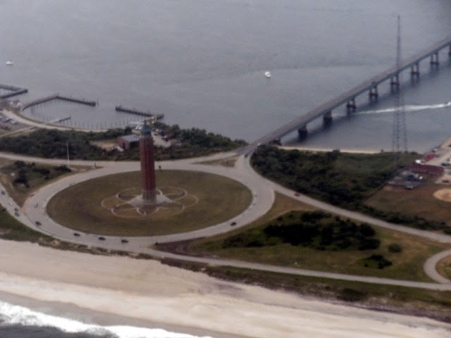
and then finally Jones Beach tower.
Jones Beach (along with Northern and Southern State Parkways, running East and West along Long Island) was designed and constructed in the 1920’s by master engineer and builder Robert Moses.

Finally, we contacted those friendly ATC folks at Islip Macarthur, began our approach and were back home.
My brother and his father in law both thanked me for the ride (right after getting out and kissing the taxiway (must be a NY thing).

Stay tuned for our Boston trip.

Sunday, December 12, 2010

I Love New York!

Okay so I know that it’s been a very long time since our last blog and many of you are assuming that we were one day lost at sea, Amelia Earhart-like, never to be seen or heard from again. As it is usually, the truth is a great deal more pedestrian.

In an effort to keep peace on the home front, this part of the story will not name names. It seems that “one of us” is waaay behind in editing her pictures (oh no, I let the cat out of the bag). (Oh well, it wasn’t terribly peaceful on the home front anyway.) Part of this has to do with the same “one of us” feeling compelled to take a picture of every cloud and every farm in the entire Midwest. So, feeling very PIC-like (an aviation term meaning Pilot in Command) and bored, grounded as I am watching the snow fall, I wrested the blog controls from “the other of us” and decided to author my own blog.

Naturally, one of the places we knew that we had to fly to since the day I got my license was back to where it all began, Long Island, New York. Fortunately, June of 2010 was my brother’s half century birthday and, I guess due to a weak moment on the part of my sister-in-law (which I’m certain she is regretting), we were invited! I immediately began making plans and in a flurry of flight plan activity, mapped out this route:


The plan called for leaving as early in the morning as “the other of us” was willing to get up (not terribly early) flying down the Chicago lakeshore, hang a left at Gary, Indiana, site of the very picturesque abandoned steel mills and continuing on to Youngstown, Ohio, famous for the…uh, Youngstown airport. Quick lunch, gas up and 3 hours later, Long Island.

Okay, so that was the plan. The actuality was that Mother Nature planned to throw some real nastiness at us the morning we were to depart. So instead, we decided to leave right after “the other of us” got home from work, fly to Youngstown, stay the night and fly the remainder the next morning. So, we launched from Waukegan at 6:30 under beautiful clear skies. As planned, we hung our left at Gary and cruised on. By 9:00 (sunset) we had passed Cleveland. Those of you not familiar with Ohio geography and landmarks may be completely unaware of what lies between Cleveland and Youngstown. Let me educate you – NOTHING. At least nothing that emits even a photon of light. So, motoring along in pitch blackness (and the glow of the instruments and GPS) with complete confidence in my “PICness” we radioed Youngstown airport when we were 20 miles out. Our call was met by a very friendly (and bored) indeed ATC guy. We subsequently began our descent and our ATC buddy gave us a hearty “Clear to land!” I responded with, “that’s very good and encouraging but could you turn the runway lights on so I can see WHERE I’m clear to land.” Boy that was met by some boisterous laughing. (I suspect this kinda stuff is WAY funnier when sitting in a swivel chair than in an airplane). Suddenly the airport appeared in all its blazing glory. We landed, taxied to the FBO (which we knew ahead of time would be closed) and apparently, that was the event of the day because all the runway lights went off and the airport was effectively closed.

Now, this next part may not be politically correct so, those of you who are sensitive are advised to read this next part with your eyes closed. I’ll tell you when you can open them again. One of the things I’ve included in my passenger briefing is that “I’ve been all the way to the back of my plane and haven’t yet found a bathroom so I’d advise you to go now before we leave”. One of the enduring mysteries of flying is that no matter how far you’re going, you inevitably have to pee about a half hour before getting there. Flying being what it is, it’s not like you can just pull over to the side of the road. Well, this trip was no exception. In fact, one of the challenges of landing at Youngstown was uncrossing my legs so I could work the rudder pedals.

So, landed we were. I got out a penlight and we began to button the plane up for the night and put its cover on. When we were done, we both walked around the plane to ensure we hadn’t forgotten anything. It was then that I heard Jolene exclaim, “Oh no, we have a problem. There’s a puddle. The back of the plane is leaking!” Assuring her that the puddle was caused not by the back of the plane but the front of the pilot made her feel marginally better.

(Okay, you can open your eyes now.)

The next morning, we launched for Long Island. Beautiful day but the cloud cover was forecast to become denser the further east we went. Bridgeport, Connecticut, where we planned to hang our right to cross Long Island Sound was forecast to be a broken layer (5/8-7/8 cloud cover). As we crossed the Hudson River at Ossining, we got a good view of the Tappan Zee Bridge.

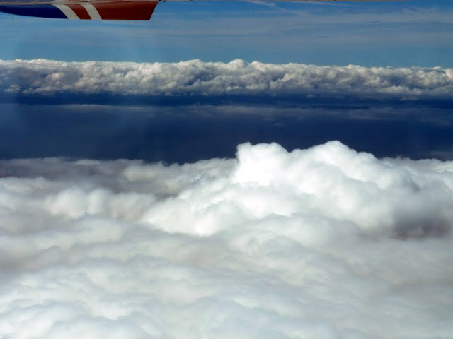
We were beginning to feel at home, having traversed that bridge hundreds of times.  Coming up on Bridgeport, it was tending more towards the 7/8 part of the broken definition but we could see that there was a similar cloud layer over Long Island but nothing over Long Island Sound.  Before hanging our right, here’s what it looked like from where I sat.


I told Jolene, “Okay, here’s the plan, we make our turn, we contact Macarthur and we descend while crossing Long Island Sound. When we get to the other side, we are under the cloud layer and we land.

So, I made my turn, contacted Islip, Macarthur and began my descent. Boy, I’ll tell you! Sometimes things work out just like you planned and make you look really smart. This was one of those times.

Even though seeing Long Island was a thrill, hearing the NY accent and the NY “attitude” from the NY air traffic controller really made me feel at home. Islip Macarthur, you’ll know, is a large commercial airport. They handle 160,000 landings and departures a year and it is a major hub for Southwest. Well, as we were on our downwind leg (heading South), there was a Southwest Boeing 737 on final. Now, it is common that air traffic control (ATC) will try to separate a small plane from landing after a big one by 3 minutes or so to avoid what is called “wake turbulence” which could cause the smaller plane to tumble (apparently, they don’t like the loud noise that a small plane landing upside down creates). So, as I was talking to Islip ATC and he told me, “ah, Cessna 179 X-ray Pop (that’s me), extend your downwind to avoid wake turbulence”. I expected this and he was telling me to keep going the way I was going for awhile to allow the vortexes created by the 737 to dissipate. After what seemed like a long while and with the Southwest long on the ground, I was beginning to leave Long Island and head out over the ocean to Florida. I thought that perhaps ATC had forgotten about me (which, BTW happens more often than you might think). So, I called and said, “ah, Islip Tower, this is 179 X-ray Pop, I’d like to begin my base turn”. (BTW, in case you were wondering, you have to preface your communications with that “ah”, it makes you sound very pilot-like.)

Now, ATC, over the entire country is very emotionless and professional. Not so, New York.

ATC shot right back with “ah, X-ray Pop, alright, I told you about the wake turbulence; do whatever you want, clear to land”.

Oh boy! We were in New York.

Great landing and here’s my Southwest buddy. Stand by for the next blog, “Adventures in New York”.

Sunday, April 25, 2010

April 2010

We flew to St. Louis, my first time there. Frank has been there on business and his business colleague always asks Frank, “Why would anyone want to go to St. Louis?” Well, I have the answer, because St Louis has a lot to offer, that’s why! Besides the Arch, Forest Park is full of free museums and there is so much more.

The morning we left, we were getting reports of 10+ mile visibility with 12,000-foot ceilings, sounds great, huh? Well, from the haze we flew through, I think the two weren’t coincident. There was 10+ mile visibility at the ground and a 12,000 foot ceiling but pretty crappy visibility between the ground and the ceiling. Oh, well! We flew right past Springfield (IL) and saw the Capitol building (sans Blago).
We landed at St Louis Regional Airport in Alton, Illinois, right across the Mississippi from St. Louis. (There’s Amelia Bearheart and the GPS leading the way to the runway.) Very friendly FBO, (West Star).
As soon as we drove out of the FBO, an F4 Phantom amidst a sea of purple and white flowering trees greeted us. Springtime in St. Louis – isn’t life grand!
I was so excited to see the Arch as we approached St. Louis. As we would learn during our visit, the Gateway Arch is a symbol of the spirit of the pioneers who made their way west. I’m guessing the long waiting lines carry that symbolism to evoke the pioneers miserably trudging across the country.
There is a visitor’s parking garage just to the north of the Arch – but of course no one tells you to go thru security at the south Arch entrance where the lines are a lot shorter. Like the rest of the lemmings, we waited in a 20-minute airport security type line just to get in to the lobby. We purposely visited the Arch before summer season, but it was still very busy. I would hate to see it during the height of their tourist season. We still had lines for security (20 minutes), lines for tickets (20 minutes), lines for the tram to the top of the Arch (1 hour), ($10) and lines to board the tram to get back down again (20 minutes). But boy, those 5 minutes at the top of the arch were breathtaking! Well, truthfully, the arch is 630 feet high and we had just finished flying in at 6,500 feet for 2 hours but, hey, ya gotta do the arch once, right?

After that, we had gotten so used to the lines, we said, “what the heck, lets wait in another line for the riverboat cruise on the Mississippi” ($14).
Since our timed tram tickets were for 1:15, and to allow 1 hour to make the trip up and down the Arch, and we had 3:00 riverboat tickets, we figured we had better head for lunch. There are no restaurants at the Arch, but just north of the Arch (a 10 minute walk) is Laclede’s Landing which has a variety of restaurants on cobblestone streets. We dined outside (it was in the low 70’s – it doesn’t get better than this!) at Hannegan’s on Second Street with a beautiful view of the Arch. Believe it or not, it reminded me of Paris where we had lunch with a view of the Eiffel Tower! Frank later shared that sentiment with his St. Louis colleague who confided that he also often confuses St. Louis and Paris. (I think they’re making fun.)

The walk to the Arch was so pretty as the Arch is in a park by the Mississippi River, and the flowering trees were just beautiful. We had enough time before 1:15 to tour the Westward Expansion Museum, which is under the Arch – this time going thru security at the south end (5 minutes). The museum is free and has very nice exhibits on the pioneers, the Great Plains and Lewis and Clark. And of course there were also the requisite gift shops.

Timing worked out well, and at 1:10 we were on line for the tram to the top. At 1:50 we finally boarded the 5-person tram (very cozy) for the 4-minute ride. Unfortunately when we reached the top, we found that the viewing area is not very large and was jam-packed. So we squeezed our way over to the small (and not very clean) windows and took a couple of photos – nice views of the Old Courthouse and Busch stadium, and then waited on line for our ride back down.
I’m glad we took the tram ride, since the Arch is an iconic symbol of the USA, (but it really isn’t worth the wait or the $).

Now it was time for our first riverboat ride on the Mississippi! Great views of the Arch, but not much of a skyline – not like Chicago or NYC. The boat travels both north and then south of the Arch. The river was fairly high – about 43’ according to the marker. At 50’ the boats can no longer fit under the bridges. There was a statute of Lewis (and Clark) supposedly at the water’s edge, but all you could see was Lewis’ hand in the air (Clark is either VERY good at holding his breath or had long since drowned.) But all in all it was a beautiful day to be on the Mississippi (unless, of course, you were Clark)!
We made our way back to the airport, and took off at 5:30. Again they were reporting 10+ miles visibility, but now it was very, very hazy. Thank goodness for Frank’s Serengeti sunglasses! Thank you Optics Planet! With a tailwind, we were back in Waukegan in 2 hours! Beats driving for 5 hours on I-55!

Saturday, February 20, 2010

We bought a plane!


We bought a plane! 
Besides, “I do!” and “I’m a father!”, there are few phrases that will bring a bigger smile to your face and greater satisfaction to your soul than those words.  So let me say them again, but louder.
WE BOUGHT A PLANE!!!!
…and what a beauty.
Actually, we weren’t even actively looking for a plane.  Oh, sure, we had agreed that once we retired and moved to Colorado, we’d buy our own plane but not now.  Then serendipity stepped in.  The club that we belonged to raised their hourly rates because no one (except us) was flying.  The economy was such that the price of used planes had plummeted.  So, on Monday morning while I was waiting for my computer to become fully operational (thanks to UL’s crack IT Department, a full boot up takes upwards of 10 minutes on a good day) I began surfing the used plane sites.  Lo and behold, I found a sparkling Cessna 172XP with only 1,700 hours since it left the Cessna factory.  By contrast, the club planes we were flying had upwards of 10,000 hours and one over 13,000.  My first question was, “what the hell is a 172XP?”  Well, it turns out that the 172XP was sold as the commercial version of the T41 Cessna that the Air Force had been using to train its fighter pilots.  The XP stands for “extra performance”.  Woo hoo!  I had found a yellow Honda S2000 with wings!
While the plain vanilla 172 has a 160 horsepower engine, this beauty has a 210 horsepower.  The run of the mill 172 that the club owns, when fully fueled, has only enough payload capacity to carry a normal sized pilot and 3 people the size and weight of swimsuit models.  The XP will carry 52 gallons of fuel and roughly 700 pounds of people.
Since, I reasoned, Jolene is so devoid of a sporting spirit that she frowns on me flying with swimsuit models, this is just the ticket.  In addition, the extra horsepower will really pay off when we move to Colorado.  In case you haven’t thought about it, an average cruising altitude in Illinois is the same as the average taxiing altitude in Colorado.
To make a long story marginally shorter, I placed an offer and the offer was accepted!  Now came the hard part of actually acquiring the plane.  Buying a plane is very similar to buying a house.  The similarities are, the financing, the inspection, the title search, the insurance, etc.  The big difference is no one to help you negotiate the morass of paperwork, which is made infinitely more complex by the contribution of the FAA.  Anyone who has had a classic bureaucracy experience with the motor vehicle bureau, think about the motor vehicle bureau combined with the IRS add bureaucratic steroids and you are beginning to get the picture.

Eventually, I signed enough paper to fill a 172 and the plane was mine.  One small problem, I now owned a plane that was vacationing in California.  Given the 2,000 intervening miles, the winter weather across the country and my business travel schedule (that didn’t include California) and I had my next challenge.  Enter my savior!
 

No, this isn’t one of the swimsuit models, stay with me here, will you!
This very capable lady is a commercial pilot building hours; my new friend, Sheri.  She agreed with a friend and instructor (Eric) to fly my new baby from where it was basking in the California sun to the snow drifts surrounding Waukegan airport in Illinois.  (I would show you a picture of “friend and instructor”, really great guy, but not nearly as “picturesque”.)

So, on February 3, my two new friends and my new plane turned out over the beautiful Santa Monica harbor and headed east.  Over the next 4 days, while doing just enough work to keep me employed, I tracked the progress minute by minute on FlightAware.COM.  This site provides not only a moving map updated every minute in real time but also enough data (altitude, airspeed, heading, etc.) to keep my engineer’s heart happy.  The first day took them from Santa Monica to Chandler (near Phoenix) Arizona.  The second day took us (me vicariously) to a small airport on the southwestern most tip of Texas.  While just previously, I had been holding my breath, watching my new addition skim only 12 miles north of the Mexican border and convinced it would be shot down as a drug runner, I was glad to see it land at around 3 in the afternoon.  I thought that we were done for the day and was surprised when “we” took off again and headed north.  At this point, I’ll turn the story telling over to Sheri.

We had just landed and discovered that this airport consisted of a single cracked asphalt runway and a mobile home that served as the center of flight operations. 
 
This “airport”, miles from anything resembling civilization, was manned by a man and his son who were “dentally challenged” and REAL glad to see us.  I was beginning to get that feeling of being an actor in the film Deliverance.  I whispered to Eric, we’re not staying here overnight.  I quickly began fueling the plane while Eric was planning our next leg.  As soon as I finished, the son, about 20 years old, sidled over and said, “you sure are one mighty fine looking woman”.  Suddenly, I began hearing the sound of banjos, I grabbed Eric and we were off.

I’m back.  At around 11PM that night, they landed at Centennial, near Denver, Colorado.  The next day, February 5, revealed a winter weather system completely blocking any chance of passage from Colorado to Illinois.  Saturday, February 6, the weather had cleared a narrow channel sufficient to allow a flight through.  At around 8:00 that night, my new beauty and my two new friends landed at Waukegan.  Since it was dark, and Sheri and Eric were unfamiliar with Waukegan airport, I thought I would play lineman and guide them in.  We’ve all seen those intrepid souls with the two flashlights guiding a plane in. Well, let me tell you, they are braver souls than I to stand in front of a 6-foot diameter spinning propeller!

Home at last.

Here is the ritual handing over of the keys. 
 
Followed quickly by the ritual toasting with the Margaritas (alright, I made THAT ritual up).  Interestingly enough, after flying from Santa Monica to Waukegan, Sheri was carded before she could order a drink!

Here it is in the daytime.
 
After living in California for so long, Jolene claims that poor N179XP is saying, “I’ve been a good little plane, why am I being punished by being banished to Illinois?”

As you can see, besides being virtually brand new inside and out, it is really nicely outfitted.
 
Now, Michelle claims that there is really only one switch to turn the plane on and off and the rest of these are just for show. 
  
Of course, she also calls the pre-flight, the “presumptuous and self-important dance around the plane” but that’s Michelle. 
It has an autopilot.  Not of course one where the plane flies itself while you audition for the mile-high club (imagine THAT NTSB report).  But once you trim the altitude and set the heading, on a long flight it pretty much does fly itself.  It also has a music jack input that allows you to listen to music but still pay attention to traffic control communications since the music automatically mutes when someone is communicating by radio.  It has a constant speed prop for blazing climbs yet great fuel efficiency and the previous owner threw in a tow bar, tie down straps and a spare headset so now we have 2 for us and 2 for passengers.  

So far, we’ve had two relatively short flights and it’s just WONDERFUL!  We’ve tried for a long flight but the weather is being, well…Illinois.  But look out this summer.  We have New York, Boston and Colorado on our list.
 

Sunday, January 10, 2010

November 2009


November ‘09
Ever since we moved to Illinois 10 years ago, we had wanted to visit Notre Dame, home of the iconic Fighting Irish (though not fighting terribly hard this season!) We flew into South Bend. Because Notre Dame had a home game we were unable to get a ride, so we rented a car. FYI – and there is a $20 ramp fee.
Be forewarned, like Green Bay, this is a town that takes its football seriously.


It was such a fun day to be on campus. The weather was perfect – in the low 70’s – such a departure from Madison where it was sooo cold. Notre Dame was playing Navy, so it seemed like everyone was wearing school colors. Our first stop on campus was the Bookstore. I have never seen such a huge bookstore – it was like being in a department store on black Friday – 2 floors jammed pack with people. I don’t think anyone walked out empty-handed. I must say we do our part to help the economy on these trips!

The visitor’s center has a short film on the history of Notre Dame. We toured the gold-capped Main Hall, the Basilica, the Grotto and the Art Museum.   But, of course, no Notre Dame trip is complete without seeing the stadium, the statue of Knute Rockne (he’s the bronze one) and the “touchdown Jesus” (seriously, I didn’t make that up).


It is such a beautiful campus. Of course the parking lot was filled with tailgaters (we parked on the street a few blocks away). We had lunch at Legends which is on the campus. I think my favorite part was when 2 F-16’s flew over the stadium just before the game was to begin!

While Frank was preparing for the flight back, I enjoyed chatting with some of the Citation Jet pilots who were passing the time away waiting to take their passengers back after the game. Do you know it takes them 16 minutes to go from Midway to South Bend!  (Note from Frank:  “Chatting” is an understatement.  You’d think she was Amelia freakin’ Earhart the way she was regaling these poor guys with tales of her flying adventures.)

November ‘09
We had heard some recommendations for Mi Tierra Mexican Restaurant at Griffith/Merrillville airport. It is located in the FBO, open from Mon-Sat 10:30am to 10:00 pm, and Sunday 8-8. They serve breakfast all day.
Not much in the way of ambiance – rather plain, but boy does it have wonderful food. Frank and I both had the chili del mar which was 2 poblano peppers stuffed with crab, shrimp and haddock with a garlic cheese sauce – yum!   The way we eat on these trips, Frank calculates weight & balance both before and after just to avoid a thrilling ride down the runway with no takeoff.

Flying there makes for a nice flight as you fly by Chicago’s scenic skyline (and then Gary’s yechh!).  So it makes for an ideal trip with guests. Because the airport is only a few miles south of Gary, rather then getting involved with transitioning thru Gary, Frank charted a course that after passing the hotels south of Chicago, homed in on the Lambert VOR which bypassed Gary’s airspace and then turned straight east to Griffith/Merrillville which lines you up with the runway. We were surprised however at the amount of traffic this untowered airport has (at times, a real test of see and avoid).


September and October 2009

September and October ‘09
We had been looking forward to our first trip to Door County. Unfortunately Mother Nature had other plans, so because of the cloud layer we couldn’t take off until 11:30. We flew into Cherryland Airport at Sturgeon Bay. (FYI – apparently you need to reserve a car quite a bit ahead of time in the fall and they seem to have the market cornered, as it is quite expensive – like $70 – so bring friends (preferably ones with wallets)! (I seem to recall we couldn’t get a ride into town – but a new FBO took over in October so maybe that will change).
We had gone up the end of September so we were hoping to see the leaves turning, but they had barely started. We had lunch in town at the Inn at Cedar Crossing – very nice and reasonable. We then toured the Historical Museum ($2 donation), which is a couple of blocks away. It has 3 floors of informative displays explaining the history of the area. Then we went back to 3rd Ave to stroll the shops. Don’t miss the Hallmark store – it has 2 floors of gift items.
So, on October 17 we flew back to Sturgeon Bay to finish seeing what we had originally planned. On the flight up, we actually flew thru some light snow at Manitowoc for a minute but finally, we saw the fall colors.


Back in town we checked out the Farmer’s Market which features baked goods, produce and crafts. We got the cutest 2 person cherry pie for $2 that I looked forward to having all day with vanilla ice cream. It didn’t disappoint! We then toured several cute gift shops at Jefferson and 7th, and then back to the Inn at Cedar Crossing for lunch as we enjoyed it so much on our first trip.

We then went over to the Maritime Museum ($7.50), which is very nice and included an exhibit on the Great Lakes Storm of 1913 in which 12 freighters sunk.  Don’t miss looking through the periscope for a view of Sturgeon Bay from all angles!
 
Next stop was Potawatomi State Park ($5 for one hour or $10 daily), which is located just north of Cherryland Airport. Driving thru the park was just gorgeous as the leaves were so beautiful. We scampered up (ok – Frank scampered and I trudged up) the 75’ observation tower for wonderful views of the bay.   (Hey, I made it…eventually.)
 
 
The view from the top.
 
We then drove up to Carlsville. On the way up we stopped at Grandma Tommy’s Country Store (4030 hwy 42/57 in Sturgeon Bay). They have everything cherry imaginable from wine to syrup to soda and so much more!  The cherry wine is AWESOME!

October ‘09

On October 31 we flew up to Madison – this time to actually do some sightseeing. (The FBO will give you a loaner car but for only up to 2 hours). Turns out we had picked a chilly day because of the wind – even though it was 45 with the wind chill it felt 35 – brrr!  (Of course, everything is relative.  As I’m writing this in January and it’s 3° out, even 35 seems tropical)  I wish I had worn my long johns as it was a little chilly touring the Dane County Farmer’s Market. It was the last day of the market for ’09. This is the largest producer-only market in the US. It surrounds all 4 sides of the Capitol, which we then toured.


You can see the Capitol either on a self-guided tour, but we were able to catch the top-of–the-hour tour (free) which gives you access to the chambers. The Governor’s Conference Room is especially beautiful – it is copied after the Council Chambers of Doge’s Palace in Venice, featuring murals and gold leaf adorning its walls.
 

We had lunch at Great Dane Pub & Brewing Co. a few blocks away. They are known for their Brat and Bacon Pretzel Burger which lived up to its’ reputation.  No fooling, this burger is worth flying in JUST for the burger (which Frank has subsequently done).  It consists of a pound beef burger, topped by a ¼ pound brat burger, topped by bacon, sautéed onions, melted cheddar all on a pretzel bun.  Boy, those Wisconsinites know how to eat, there’s probably not a dieter in the whole state.

Then back to Capitol Square where we toured the Wisconsin State Historical Museum ($4 suggested donation) and then the Wisconsin Veteran’s Museum (donations); both very nice. The Veteran’s Museum has 4 galleries on different wars that Wisconsin veterans participated in, starting with the Civil War.

Stay tuned for November!